 NGDC for Kenya
Department of Land Surveys Uganda
Type of resources
Topics
Keywords
Contact for the resource
Provided by
Formats
Update frequencies
status
Scale
-
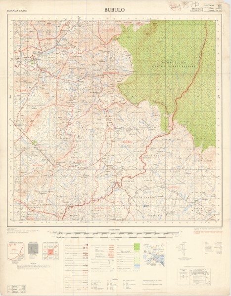
Y732 (1: 50 000 scale) Topographic Maps area a series of maps produced by the Uganda Governemnt between 1963 and 1972. The maps cover the interbational boundary area between Kenya and Uganda. Previous versions of the maps have been published and it is possible that further editions have been released. The list contains those maps from the series currently (November 2018) held by the Geodata Centre.
-
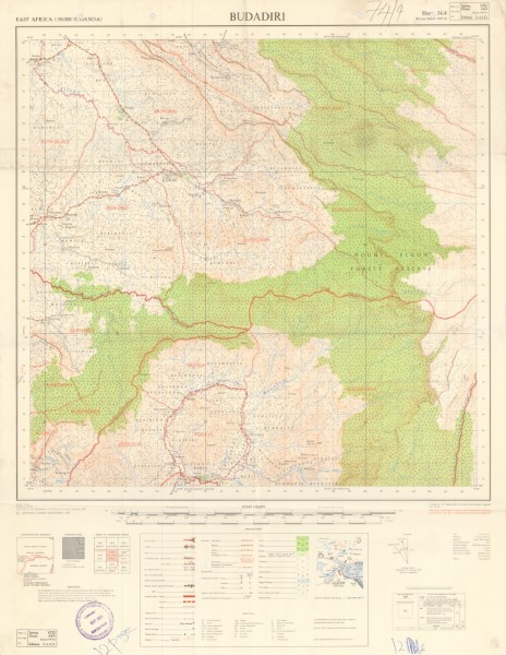
Y732 (1: 50 000 scale) Topographic Maps area a series of maps produced by the Uganda Governemnt between 1963 and 1972. The maps cover the interbational boundary area between Kenya and Uganda. Previous versions of the maps have been published and it is possible that further editions have been released. The list contains those maps from the series currently (November 2018) held by the Geodata Centre.
-
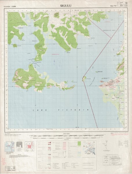
Y732 (1: 50 000 scale) Topographic Maps area a series of maps produced by the Uganda Governemnt between 1963 and 1972. The maps cover the interbational boundary area between Kenya and Uganda. Previous versions of the maps have been published and it is possible that further editions have been released. The list contains those maps from the series currently (November 2018) held by the Geodata Centre.
-
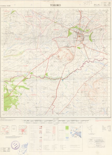
Y732 (1: 50 000 scale) Topographic Maps area a series of maps produced by the Uganda Governemnt between 1963 and 1972. The maps cover the interbational boundary area between Kenya and Uganda. Previous versions of the maps have been published and it is possible that further editions have been released. The list contains those maps from the series currently (November 2018) held by the Geodata Centre.